I am using this space to comment on the recent very heavy rainfall in North Dorset.
Saturday, 7th July 2012, had intermittent rain,
but by evening it had settled into steady, heavy rain. There was no wind to notice. The rain simply dropped. On Sunday morning I awoke to find that the nearby (other side of
the road) ‘parks’ were both under water and you couldn’t see the arches of the
road-bridge.
Perhaps I should explain. These areas were made into parks for
aesthetic reasons and to improve public enjoyment of the riverside meadows. However, they are designed primarily as an intrinsic part of the
flood-defence plans. Left alone they
would have been rough land and full of weeds that would have spread into nearby
gardens.
I have seen them flooded before,
but not quite as extensively as this weekend.
Interestingly, by mid-morning the water-level was down again and, by
evening, you couldn’t tell there had been flooding apart from a few bits of
debris. The system certainly works. I was speaking early yesterday with people who have lived all their lives in Gillingham. Many said it was the highest they had seen the rivers, but, thanks to two decades and more of engineering, there had been no disruption of normal life.
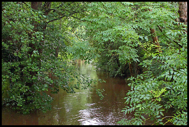
These pictures are of the water
just across the road at the side of my house and the river is the R. Lodden.
The river-course follows the line of the trees at the far side of the water.
 |
| The main Gillingham to Shaftesbury road |
 |
| Taken from the road-bridge looking downstream |
 |
| A manhole on the road-junction |
Gillingham has a total of three rivers. I went into the town to look at
the other two.
This is the river Shreen Water
and the bridge is Town Bridge. Town
Bridge is a listed building and a painting of it by John Constable hangs in the
Tate Gallery.
Although the water does not
appear to fill the arch completely, a Kingfisher flying down the river chose to go
over it to cross the High Street.
Upstream from the bridge, and behind the point from which this image was taken, is the site of
the old Town Mill. This had been a major and
impressive building in the town, but burnt down in 1981. Eventually retirement flats were built after
considerable delays caused by the recognition that consideration had to be
given to flood-avoidance measures. The
new building is certainly a handsome one and the old mill-race runs round it. The sluice gate is a feature of the
landscaping in the gardens of the building.
To avoid back-up behind the gate, there is a relief pumping system that
cuts in automatically and ejects water from behind the gate into the river
below. When I was there yesterday that
was operating every few minutes.
There is a small footpath
alongside the river on the bank opposite the apartments. It runs from the High Street between the river and a public car
park and leads to a small garden. It stops opposite the sluice
gate. Should the unexpected occur and
the river rise too high at this point, the flood-waters would be contained
within the river channel by a small wall that interrupts the footpath into the public car park and site of the town war memorial. Passage is facilitated by a flight of steps
on each side.
My journey took me next to the third, but arguably most
important, river in the town. The one
that retains its identity all the way to the English Channel – the
River Stour.
 |
| Looking downstream from the old ford site |
 |
| Looking upstream from Chantry Fields |
 |
|
The confluence of the R. Stour and Shreen Water
(R. Stour flowing L to R; Shreen Water entering
opposite) |
There is a foot-bridge crossing the R. Stour from near
the library and the Waitrose supermarket.
The path used to go down the slope of the landscaped flood-meadow and
the bridge spanned the water-course.
Whenever it rained heavily the path at the ends of the bridge became
boggy very quickly. Four or five years
ago a new bridge was constructed. This
takes off at more or less pavement height next to the library car park and crosses
both the flood-meadow and the river-course to meet the rather steeper path on
the town-centre side of the river. You
no longer have to negotiate puddles.
After this weekend’s heavy rain, the true worth of this new bridge is
clearly demonstrated.
No feet were wet in the making of this blog.


No comments:
Post a Comment